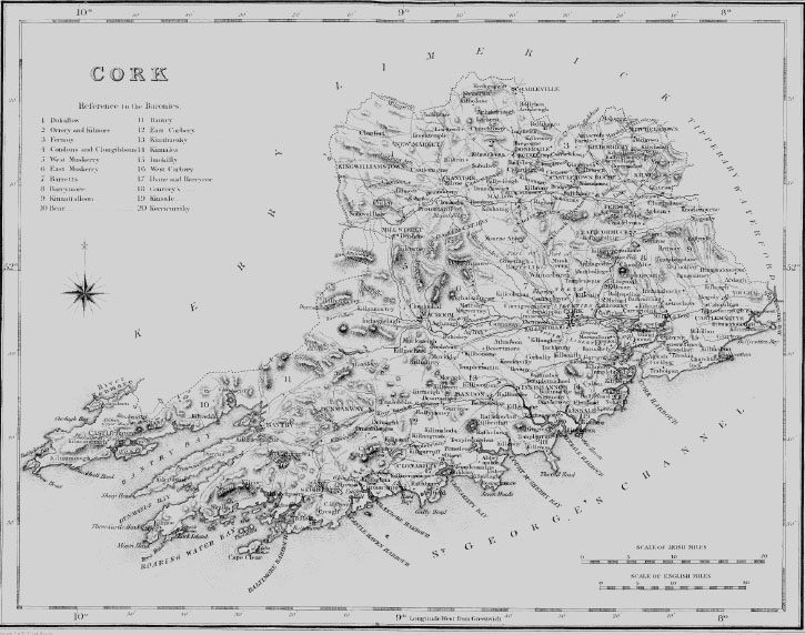
| BALLYFEARD, a parish, in the barony of KINNALEA, county of CORK, and province of MUNSTER, 4- miles (N. E. by E.) from Kinsale; containing 1337 inhabitants. This parish comprises 4500 statute acres, of which 3576 are applotted under the tithe act and valued at £2460 per annum: about 3500 acres are arable and pasture, and 1000 waste and bog. The land is in general very good and principally under tillage; but agriculture, as a system, is comparatively unknown; the chief manure is sea-sand, which is brought from Menane Bridge, three British miles distant. It has been proposed to cut a canal from Belgooley to the river Menane, and application has been made to Government for that purpose, but nothing has been yet decided. The village contains 24 houses indifferently built; it is a constabulary police station, and petty sessions are held every alternate Wednesday. The living is a vicarage, in the diocese of Cork, and in the patronage of the Bishop; the rectory is impropriate in the Earl of Shannon; the tithes amount to £260, of which one-half is payable to the impropriator, and the other to the vicar. There is no church, but divine service is regularly performed in the parochial school-house, which is licensed for that purpose. The glebe comprises five acres, but there is no glebe-house. In the R. C. divisions this is one of the three parishes that constitute the union or district of Clontead; the chapel at Ballingarry is a plain thatched building. The parochial school and a Sunday school are under the superintendence of the vicar: there are also two pay schools in the parish. |