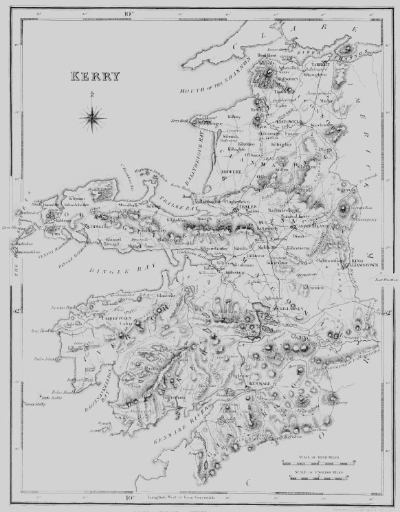
| BLASQUET ISLANDS, also called BLASQUES or FERRITER'S ISLANDS, lying off the shore of the parish of DONQUIN, barony of CORKAGUINEY, county of KERRY, and province of MUNSTER, 10 miles (W. S. W.) from Dingle; the population is returned with Donquin. These islands were granted by the Earl of Desmond to the family of Ferriter, but were forfeited to the Crown by their joining in the rebellion of that nobleman, and in 156 were granted, with other possessions, to George Stone and Cornelius Champion; they were afterwards purchased by Sir Richard Boyle, ancestor of the present proprietor, the Earl of Cork. They are rated for the county cess with the parish of Donquin, but for tithes with that of Ballinvohir, on the northern shore of Dingle bay. In September, 1588, part of the Spanish Armada, consisting of the admiral's ship the St. John, a large ship of 1000 tons called "Our Lady of the Rosary," and some smaller vessels, came into the Sound in distress. Our Lady of the Rosary struck on a rock and was wrecked, and of 500 persons on board, among whom were the Prince of Ascule and 100 gentlemen, only the pilot's son was saved: a violent storm soon after dispersed the rest of the ships. The islands, which are the most westerly on the coast of Ireland, are situated in Lat. 52( 6' 40" (N.), and Lon. 10( 33' (W.), as taken from the southern point of the Great Blasquet; they are twelve in number, including those which are mere rocks and extend 2? miles W. by S. The largest is called the Great Blasquet or Innismore, and is nearly two miles from the main land : it is about three miles in length, and is elevated mountain ground, with some arable land towards the north-east extremity: ten families reside upon it at present, and there are the ruins of a very ancient church, with a burial-ground. The second in size, and the southernmost, is Innismackilane, which lies about seven miles W. by S. from Dunmore, and is low and bleak, but yields a very rich herbage : it is the abode of two families, and contains the ruins of an ancient chapel with a burial-ground, and a small stone. roofed cell or hermitage, with the remains of several others. The third is Innisnebroe or Quern Island, so called from its resemblance to the old mill-stones called "querns." The fourth and most northern, called Innistuskard, is about an Irish mile in length: only one family resides on it, and there is a stone cell similar to that above noticed. Near the Great Island are three smaller, one of which is called Innisbeg or the Little island, and consists of about 16 acres of rich grazing land; the other two are of the same character, but not so large. Most of them are stocked with sheep and black cattle, and abound with rabbits and sea-fowl, of which the last breed in vast numbers on the stupendous pyramidal rock forming the eighth island, and situated four miles W. N. W. from the Great island, and are taken for their feathers : near this rock is another of a similar form but inferior height. Here are also numbers of hawks and eagles, the former of which were once held in great esteem for sporting ; and a small bird, called by the Irish gourder, and said to exceed the ortolan in deliciousness of flavour, appears to be peculiar to these islands. Smith, in his History of Cork, published in 1749, says that, for the space of 45 years before he visited the Great island, "neither man, woman, or child died on it." |
| DONQUIN, or DUNQUIN, a parish, in the barony of CORKAGUINEY, county of KERRY, and province of MUNSTER, 7 miles (W. S. W.) from Dingle ; containing, with the Blasquet or Ferriter's islands, 1363 inhabitants. This parish is situated at the south-western extremity of the peninsula of Dingle, and terminates in the promontory called Dunmore Head, the most westerly point of Ireland. The latter is called in Irish Tig Vourney Geerane, or "Mary Geerane's House," in like manner as the extreme point of North Britain is called "John O'Groat's." Dunmore Head is in N. Lat. 52- 8' 30" and in W. Lon. 10- 27' 30" : it lies about 5 Irish miles (W. by N.) from the entrance of Ventry harbour, and 3- miles (W.- S.) from the west end of the island called the Great Blasquet, The parish contains 4937 statute acres, as applotted under the tithe act, of which nearly one half consists of coarse rocky mountain pasture, interspersed with patches of bog ; the remainder is in tillage : sea-weed is extensively used for manure, and the state of agriculture is gradually improving. At Clohun is a small harbour for fishing boats employed during the season in taking mackerel, scad, and turbot ; and at Ballyikeen is a station of the coast-guard. It is in the diocese of Ardfert and Aghadoe ; the rectory is impropriate in Lord Ventry, and the vicarage forms part of the union of Marhyn. The tithes amount to £75, payable in moieties to the impropriator and the vicar : divine service is performed every Sunday at the coast-guard station. In the R. C. divisions the parish forms part of the union or district of Keel, or Terreter. A school has been recently built at Ballyikeen. On the rocky coast of this parish are often found the beautiful crystals called Kenny stones. The ruins of the church still remain in the burial-ground, where the Prince of Ascule was interred after the wreck of part of the Spanish Armada off this coast.-See BLASQUET ISLANDS. |